Anonymous
6/14/2025, 7:07:11 PM
No.2044430
[Report]
>>2044292 (OP)
The cheap chink LED strips MUST get through
Anonymous
6/15/2025, 12:56:13 AM
No.2044478
[Report]
>>2044509
>>2044292 (OP)
>>2044299
I live 15 minutes outside a capital city in the US, and I can hear overpassing aircraft at cruise altitude clearly on a quiet morning.
You think everyone in Iraq cranes their head up to the sky every time someone flies over?
Anonymous
6/15/2025, 7:05:04 AM
No.2044509
[Report]
>>2044478
It was more why would you directly fly directly over Iran in the middle of a conflict?
Anonymous
6/15/2025, 11:55:36 AM
No.2044539
[Report]
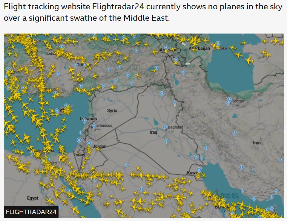
Yesterday there was this line straight down Jordan next to the Zionist Entity. Are Jordanians retarded?
DVT
!!0h0kP1x7rCh
6/16/2025, 4:05:26 PM
No.2044717
[Report]
>>2044839
May I ask y'all somethin'?
I've been searching around for a while now, and is there an application or program that can basically:
1) Provide a High-Resolution Map of the whole planet
2) Have most city names on it, including even small ones
3) Full coordinate lines (not really skipping any)
4) Can be viewed basically like a map laid out on a table (not in a "globe" format (Google Earth)).
Am I retrado?
Anonymous
6/17/2025, 2:48:05 AM
No.2044839
[Report]
>>2044919
>>2044717
Try viewing Natural Earth's GIS files in QGIS.
Country borders and cities:
https://www.naturalearthdata.com/downloads/10m-cultural-vectors/
Coastlines:
https://www.naturalearthdata.com/downloads/10m-physical-vectors/
QGIS:
https://qgis.org/download/
Open QGIS and use it to open the .shp (shapefile) files.
>Full coordinate lines
This is called a graticule. You can create it in QGIS by following these instructions:
https://blog.martinb.za.net/2020/graticules-in-qgis/
>Can be viewed basically like a map laid out on a table
This is called a map projection. You can select a map projection for viewing your data in QGIS by changing the "project coordinate reference system".
https://docs.qgis.org/3.40/en/docs/user_manual/working_with_projections/working_with_projections.html#project-coordinate-reference-systems
Anonymous
6/17/2025, 6:49:45 PM
No.2044920
[Report]
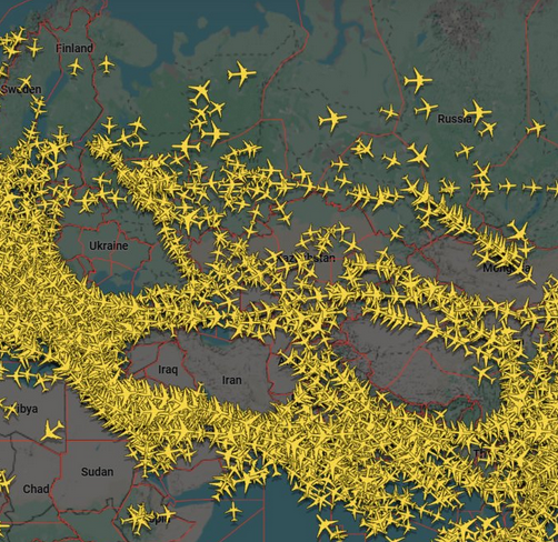
You've got the gulf Airlines running flights *from* Syria both over Lebanon and Jordan/KSA so why isn't their overflights?
Anonymous
6/18/2025, 10:50:01 AM
No.2045034
[Report]
>>2045035
kek
Remember when le mongoloid boomer man said he was going to attain world peace in a day?
Anonymous
6/18/2025, 11:45:23 AM
No.2045035
[Report]
>>2045034
Damn I didn't even know there's a war in the Himalaya
Anonymous
6/18/2025, 6:33:53 PM
No.2045066
[Report]
>smashed human skull visible from space
this will continue to go badly I feel