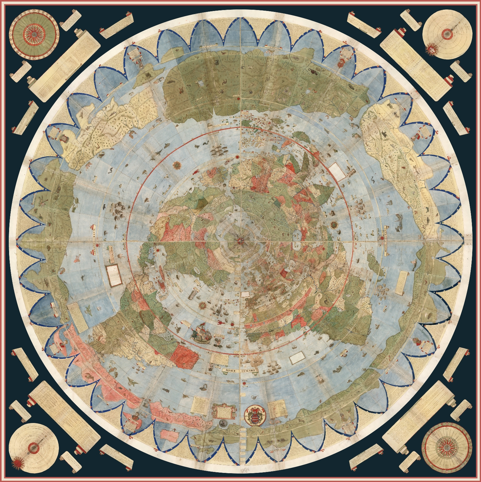
>Urbano Monte made an extremely detailed 1587 world map 10 feet wide
>polar projection (flat earth map)
>north pole at the center surrounded by land and 4 giant rivers
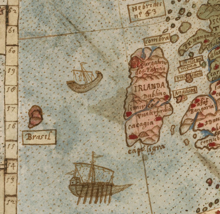
Notably, it depicts islands absent from modern satellite imagery. Think Strava 2018 heat map.
It can be examined at incredible resolution here https://www.davidrumsey.com/blog/2017/11/26/largest-early-world-map-monte-s-10-ft-planisphere-of-1587
A projection means the Earth isn't flat though
>>509393609 (OP)>it depicts islands absent from modern satellite imagery.Maybe he was wrong and/or made them up for filler
It also shows boats and sea monsters and giant lobsters and shit...apart from being inaccurate.
Must have been a /pol/ tier schitz retard that made it.
>>509393609 (OP)>Notably, it depicts islands absent from modern satellite imagery.Wait till you learn about Hy Brasil lol
That never existed yet I'm sure I've meet someone from there
>>509393609 (OP)no one cares you dumb jewish clown
>>509395317ANCIENT FLOATING ISLAND BRASIL RISE UP
>>509395317Yup that, funny enough I've heard about it from some stranger at the airport. Due note that he was white and didn't say Brasil but Hy-Brasil the whole time. Stranges encounter of my life
>>509396499To be fair Hy Brasil did exist for roughly 100 years. The Portugese sailors brought home a lot of Brazilians/Neenees etc and put them on the island. Shame about the massive Atlantic hurricane. We could have had cute indian irish hybrids.
>>509396879But the guy I've meet was white and he spoke English like Clarkson from Top Gear. I regret not googling his country right there but I was convinced he was talking about Brazil even though it didn't make any sense what he was saying about