Search Results
4/26/2025, 1:38:24 AM
>>2898878
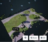
I want to make a survey drone so it can photo my crop. I have 10 acres and I need it to fly up and down the rows of corn taking photos of ever square foot then i'm gonna stitch the photos together to make a composite image. I want the drone to be 7 feet off the ground, I'm asking has somebody done this were you put the corners in some software as gps locations and say survey the parcel?
I want to make a survey drone so it can photo my crop. I have 10 acres and I need it to fly up and down the rows of corn taking photos of ever square foot then i'm gonna stitch the photos together to make a composite image. I want the drone to be 7 feet off the ground, I'm asking has somebody done this were you put the corners in some software as gps locations and say survey the parcel?
Page 1