The world map in EU5 is Paradox's most ambitious to date, meticulously crafted from historical sources and reaching from 1337 to 1837 and featuring over a thousand playable nations. For example, the Holy Roman Empire is depicted as a myriad of tiny states, each with distinct pops and borders, with some locations and nations as small as single cities.
To make this granularity possible, the map is split into approximately 30,000 detailed locations, which serve as the base building blocks of this world. These locations can be anything from rural hubs focused on food production, to sprawling urban centers.
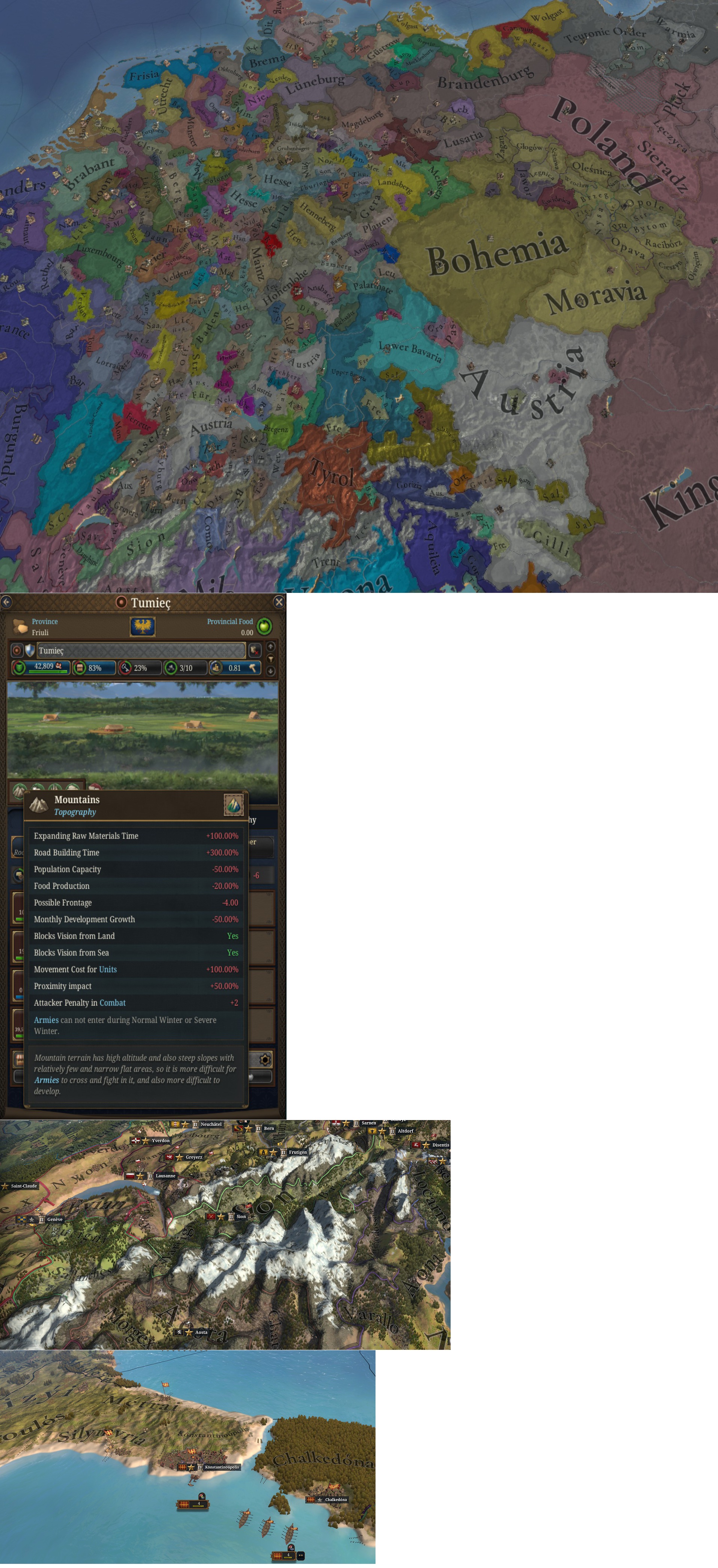
Beyond the settlements themselves, geographic features play a crucial role in gameplay. Each location is defined by its climate, vegetation, and topology. These three elements directly impact strategic decisions; for example, cavalry will dominate the flat plains, while infantry excel in hills.
The map's visual splendor enhances immersion, with seasonal changes like snow-covered alps in winter and lush Indian plains in monsoon. These changes are not just visual; they provide tangible game effects, such as blocking army movement or disrupting production.
Rivers and straits act as strategic chokepoints, vital for trade and defense, as exemplified by the Bosphorus when the Ottomans sought to secure trade routes.