Confederate Meteorologist
(ID: JflWQrZ5)
8/14/2025, 1:19:05 AM
No.512988320
>>512988498
>>512989511
>>512992094
>>512992397
>>512992655
>>512992706
>>512994713
/AHSG/ Atlantic Hurricane Season General - the raping of myrtle beach edition
>breakdown
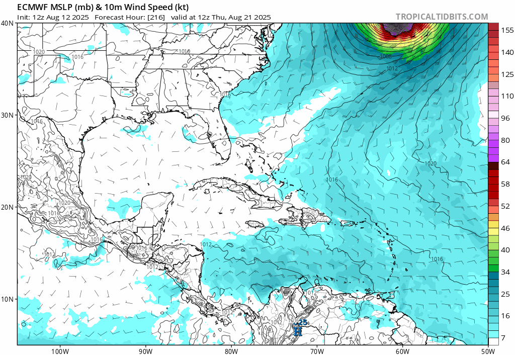
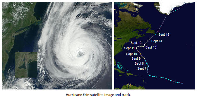
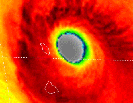
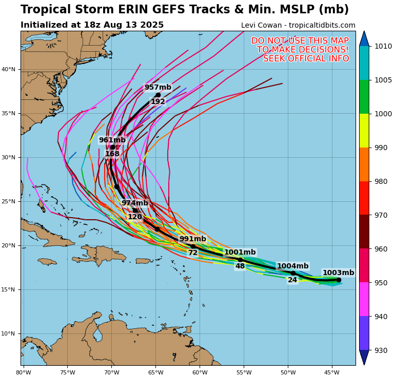
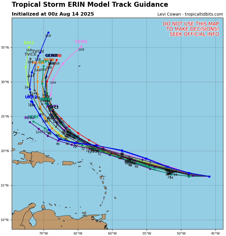
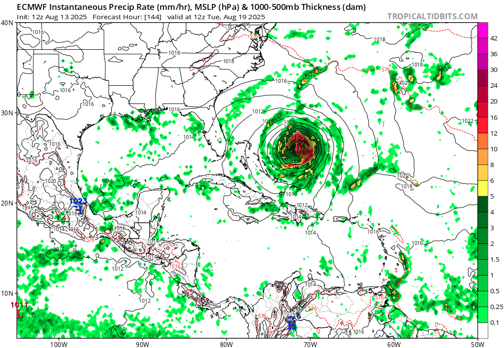
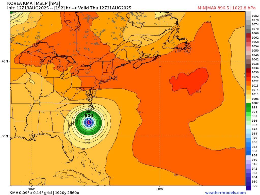
Tropical Storm Erin is in the central Atlantic slowly getting it's act together. The margin for out to sea are closing in fast and we're still would only start to have a better idea by Sunday Morning. The trends are getting hard to ignore and it is becoming apparent that all trends point to US impacts, most likely in the Carolinas but can't rule out Atlantic Florida just yet, especially with given trends. This is expected to become a powerful storm regardless of where it is going and anywhere it lands would be catastrophic as no major hurricane has really hit the area since Hurricane Hazel of 1952 and it's likely to be more intense than that. Be aware anons, Erin is coming.
>Preparations and Safety
Evacuation orders and map for Florida https://www.floridadisaster.org/evacuation-orders/
https://www.redcross.org/get-help/how-to-prepare-for-emergencies/types-of-emergencies/hurricane.html
https://www.ready.gov/hurricanes
https://www.weather.gov/safety/hurricane
>Sats and visuals
https://weather.cod.edu/satrad/
https://www.star.nesdis.noaa.gov/GOES/index.php
https://www.nrlmry.navy.mil/tcweb/active/
https://realearth.ssec.wisc.edu/?products=MIMICTPW2E.100&×pan=-30t&animationspeed=100&animate=true
>Info and Data
www.nhc.noaa.gov
www.ndbc.noaa.gov
>Models
https://www.tropicaltidbits.com/analysis/models/
https://www.pivotalweather.com/model.php
https://weather.us/model-charts
http://spaghettimodels.com/
storm.aoml.noaa.gov