>>40841821
Approved For Release 2003/04/18 : CIA-RDP96-00791R000100420002-0
Kerguelen Island Site (Price)
Date: 20 July 1973, 1400, Menlo Park, California
Protocol: Coordinates 49°20'8, 70°14'E given by Dr.
H. E. Puthoff to subject Price by telephone to initiate experiment.
Price Response:
On the morning of 21 July 1973 Price's written response (dated 20 July 1973, 2055-2232, Santa Clara, California) was received (hand carried).
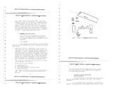
Picked 15,000' altitude. Looking south, 4° east of south, see a site located on a cliff about 200' high above the ocean. Installation is a cluster of buildings and radar tracking station (see Figure 7). Radar is a segment concave type rather than circular dish type. Building #1 is the largest, L-shaped, front facing NW, two stories plus basement. Buildings #2 and #3 about 75'-100' east of main building, also two stories plus basement.
Building #2 has recreation and dining facilities, building #3 contains living quarters. Building #4 is a shop and maintenance area. Buildings are all interconnected on the ground floor. I see a dock area at the base of the cliff, and 1/4 to 1/2 mile from the buildings is an airstrip.
The installation has four functions:
1) Tracking (space)
2) Meteorological station
3) Monitoring equipment for radiation readings
4) Radio relay station.
4chan Search
1 results for "2eeaac2c42b3964f4d50b6cbe8f4609b"
