Approved For Release 2003/04/18 : CIA-RDP96-00791R000100420002-0
Kerguelen Island Site (Swann)
Date: 21 July 1973, 1708-1730, Menlo Park, California
No maps were permitted and the subject was asked to give an immediate response. The session was recorded on video tape.
Swann response:
My initial response is that it's an island, maybe a mountain sticking up through a cloud cover. Terrain seems rocky. Must be some sort of small plants growing there. Cloud bank to the west. Very cold, I see some buildings rather mathematically laid out. One of them is orange. There is something like a radar antenna, around disc. (Subject draws map during report.) Two white cylindrical tanks, Wind is blowing.ing. Behind, is quite large. To the northwest a small airstrip. Must be two or three trucks in front of building. Behind that is an outhouse? There's not much there.
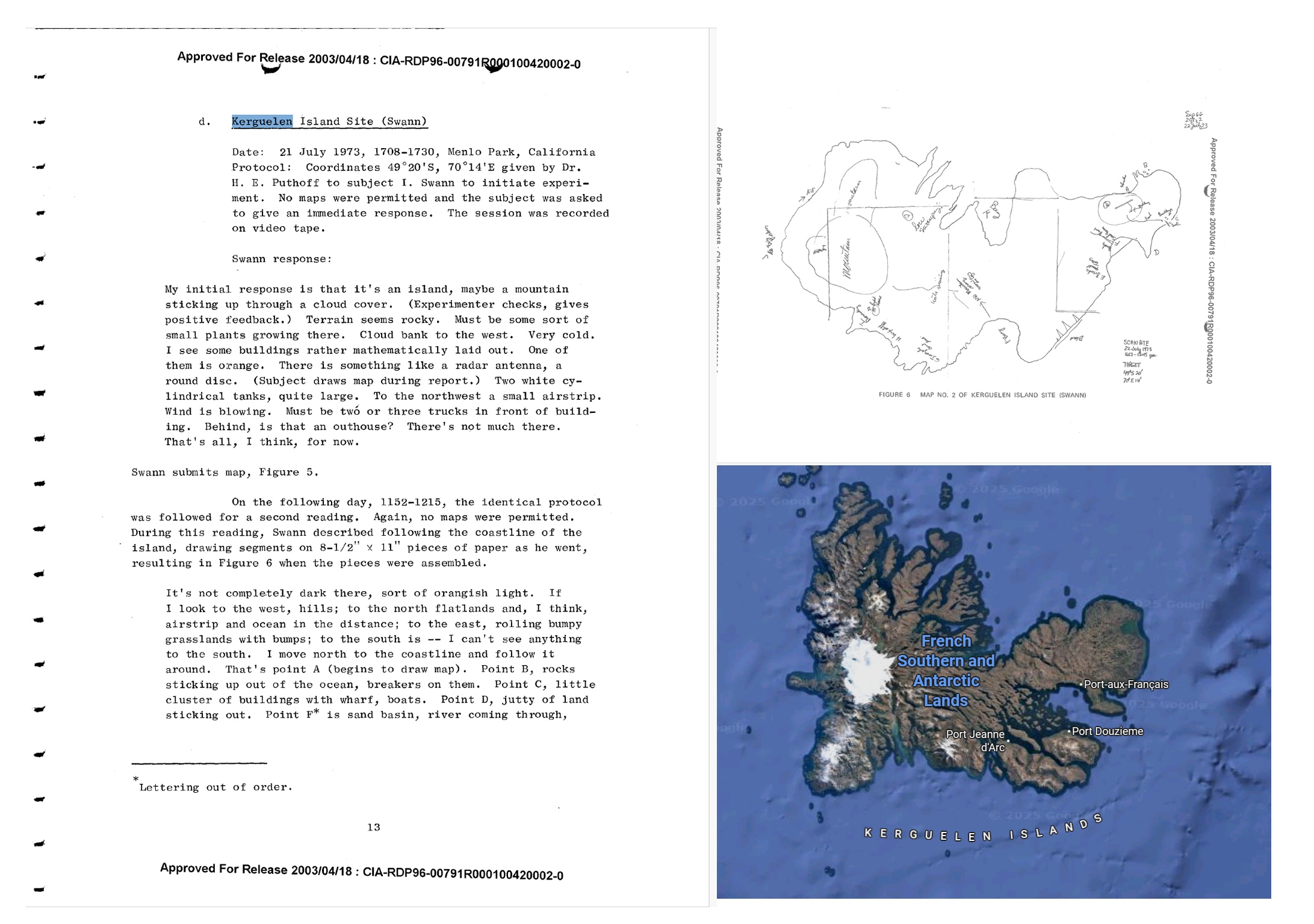
During this reading, Swann described following the coastline of the island, drawing segments on 8-1/2 X 11 pieces of paper as he went, resulting in Figure 6 when the pieces were assembled.
It's not completely dark there, sort of orangish light. If I look to the west, hills; to the north flatlands and, I think, airstrip and ocean in the distance; to the east, rolling bumpy grasslands with bumps; to the south is -- I can't see anything to the south. I move north to the coastline and follow it around. That's Pt. A (begins to draw map). Pt. B, rocks sticking up out of the ocean, breakers on them. Pt. c, little cluster of buildings with wharf, boats. Pt. D, jutty of land sticking out. Pt. F* is sand basin, river coming through,lots of birds. Pt. E, brush of small trees.
Following E) almost a straight coastline, cuts in rocks, beach. Then curves back. I see to northwest a mountain rising, snow on top. Area G is irregular. Pt. H is a high cliff, Pt. I is a promontory. Pt. J has big breakers, K is a bay, Lis area I drew yesterday (circles area, draws airstrip and buildings for orientation to previous map).