Pic rel is a simple template you can paste over your old map to update it, but only if your old map is the 4.0.4 edition. Otherwise you have to use the template in the OP.
Changelog for the 4.0.5 edition:
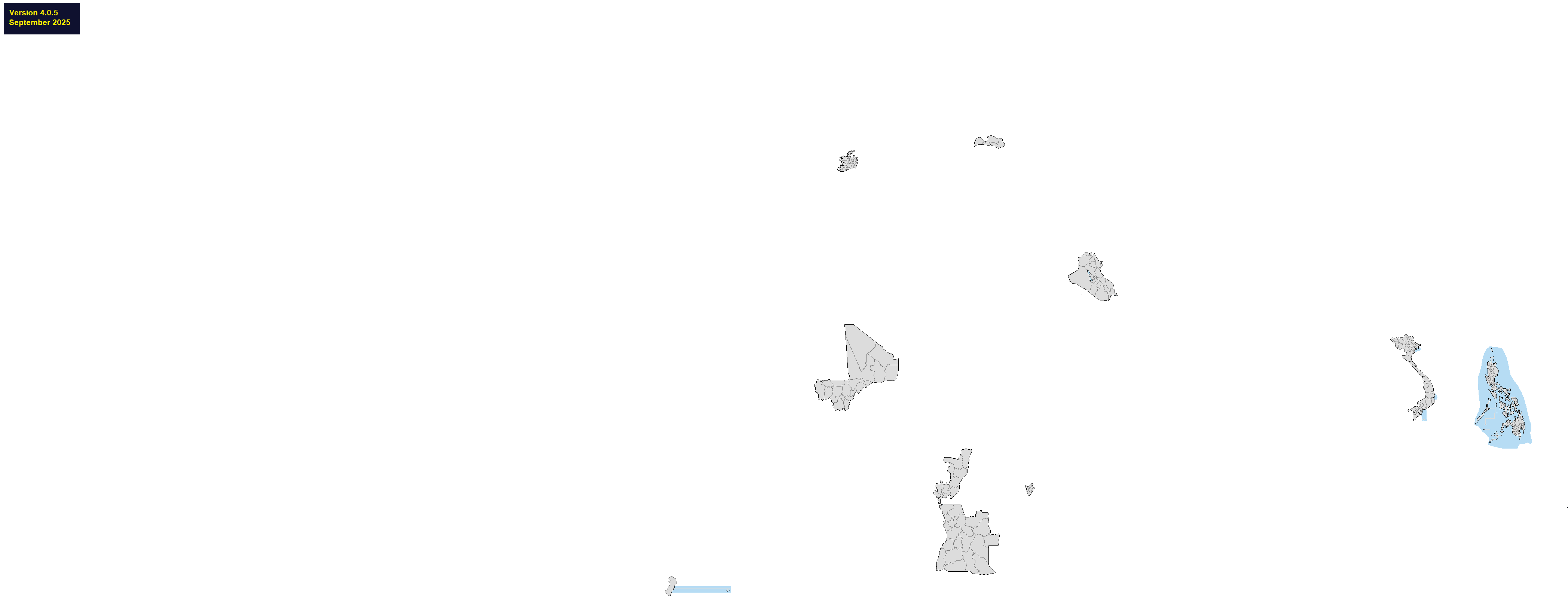
>changed to the borders of the Historical Latvian Lands, formerly the Cultural Regions of Latvia
>added three new provinces of Angola
>added nine new regions of Mali
>reduced the number of provinces in Burundi as per their new administrative reform
>added five new city and city-and-county councils in Ireland (Galway, Cork, Dublin)
>merged the provinces of Vietnam following their regional reform
>tweaked the borders of Iraq and the Republic of the Congo
>joined Trinidade and Martim Vaz to Espiritu Santu in Brazil, as per an Anon's request
>fixed some pixels in Indonesia
>new DLC, Danish counties and Montenegrin municipalities (IMHO they didn't turn out that pretty, but hey, they're there if you want to use them)
>the British Indian Ocean Territory will be handed over to Mauritius, but the deal isn't ratified yet so I've waited to include it on the map
Philippines. Too complicated for a single line of greentext. Fixed the regional borders, I added Negro Islands Region as well as separated Sulu from Bangsamoro, Sulu is not a part of any region anymore but it's not a region in itself either, so who knows what they're doing. I then replaced the regions with the provinces, as those are the ones actually used for administrative purposes, I THINK. It's not entirely clear. I asked /asean/ on /int/ and that was how I understood it, that the provinces are the primary administrative division, and the regions are more statistical groupings. Manila and Zamboanga City are not part of any province, so they are added separately. The city of Isabela is part of Zamboanga REGION, but Basilan PROVINCE. Correct me if I'm wrong in any of this. In any case, the regions have been added as DLC.