
>>509707063
For the US, Albers projection is best projection.
4chan Search
2 results for "1f082df1bb6fc53e69afb7bc5b49098b"

>>149651643
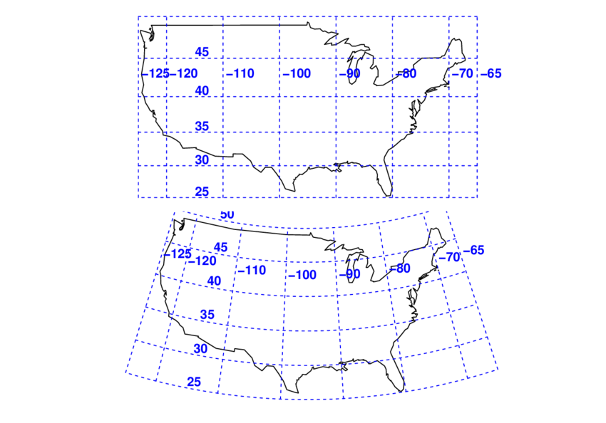
The map projection used (pic related top) makes the northern portion look larger than it actually is. I used that projection so the lines would be straight because people who don't have a background in geography already whine about it not feeling true to them.
Ideally I would have used an Albers Projection (pic related bottom), which is great for the contiguous United States, but I knew once someone saw the curved latitude lines, they'd post something ignorant.